
Mountain weather
Peak District Mountain weather forecast table
Confidence
High for changeable conditions before turning much warmer from midweek, and probably thundery from later Wednesday. Lower confidence for precipitation and cloud detail.
This evening forecast
Any showers this evening will slowly weaken toward dusk.
Mountain weather hazards
Hazards apply at or above 300m, reflecting the more severe conditions which can occur at altitude.
 Poor Visibility
Poor visibility presents challenging route finding conditions. Visibility could be significantly less than 50 metres in all directions with few or no visual references, especially on featureless moors or plateaux. Distances become hard to judge and cliff or cornice edges can be difficult to recognise. These conditions require good navigational skills. There is a risk of white-out conditions when mist or fog is combined with extensive snow cover.
Strong Sunlight
Harmful UV levels from sunlight increase with altitude giving a greater risk of sunburn and eye damage, even on some overcast days. On breezy days, the cooling effect of wind on exposed skin may disguise any feeling of sunburn until it is too late. If there is snow cover, glare increases the effect of UV rays especially on the eyes. It is advisable to wear sun block, protective clothing such as a long-sleeved top and hat and have good quality eye protection.
Mountain weather forecast
Mostly dry start with limited bright spells, thickening cloud bringing outbreaks of rain through the afternoon and evening.
| Time | 00:00 | 03:00 | 06:00 | 09:00 | 12:00 | 15:00 | 18:00 | 21:00 |
|---|---|---|---|---|---|---|---|---|
Weather (at 600m) |
|
|
|
|
|
|
|
|
Chance of precipitation (at 600m) |
<05% | <05% | 10% | 10% | 30% | 50% | 70% | 90% |
Wind direction and speed (mph)
Altitude above mean sea level
| Time | 00:00 | 03:00 | 06:00 | 09:00 | 12:00 | 15:00 | 18:00 | 21:00 |
|---|---|---|---|---|---|---|---|---|
| 600m |
W
13
|
W
12
|
W
12
|
SW
13
|
W
13
|
SW
15
|
SW
15
|
SW
18
|
| 300m |
SW
9
|
SW
8
|
SW
9
|
SW
10
|
W
10
|
W
11
|
SW
10
|
SW
13
|
| Valley |
SW
5
|
SW
4
|
SW
5
|
SW
8
|
W
8
|
W
8
|
SW
7
|
SW
9
|
Wind gust (mph)
Altitude above mean sea level
| Time | 00:00 | 03:00 | 06:00 | 09:00 | 12:00 | 15:00 | 18:00 | 21:00 |
|---|---|---|---|---|---|---|---|---|
| 600m | 18 | 17 | 17 | 18 | 20 | 22 | 22 | 25 |
| 300m | 14 | 13 | 13 | 15 | 16 | 18 | 16 | 20 |
| Valley | 12 | 11 | 11 | 15 | 15 | 17 | 16 | 20 |
Altitude above mean sea level
| Time | 00:00 | 03:00 | 06:00 | 09:00 | 12:00 | 15:00 | 18:00 | 21:00 |
|---|---|---|---|---|---|---|---|---|
| 600m |
8°
|
7°
|
8°
|
8°
|
10°
|
9°
|
9°
|
8°
|
| 300m |
10°
|
9°
|
10°
|
11°
|
13°
|
12°
|
12°
|
11°
|
| Valley |
10°
|
10°
|
10°
|
12°
|
14°
|
12°
|
12°
|
11°
|
| Freezing Level |
1,800m
|
1,700m
|
1,600m
|
1,700m
|
1,800m
|
1,800m
|
2,100m
|
2,600m
|
Altitude above mean sea level
| Time | 00:00 | 03:00 | 06:00 | 09:00 | 12:00 | 15:00 | 18:00 | 21:00 |
|---|---|---|---|---|---|---|---|---|
| 600m |
4°
|
4°
|
4°
|
5°
|
7°
|
6°
|
6°
|
5°
|
| 300m |
8°
|
7°
|
8°
|
9°
|
11°
|
10°
|
10°
|
8°
|
| Valley |
9°
|
9°
|
9°
|
10°
|
12°
|
11°
|
11°
|
10°
|
Additional weather information
Meteorologist's view
Generally good conditions in the morning, but visibilities deteriorating through the afternoon and evening as cloud lowers onto summits later.
Weather
Mostly dry conditions with occasional clear periods through the early hours. Some limited bright or sunny spells through the morning and often dry, although there will be the odd shower, but these much lighter than over the weekend. Into the afternoon and evening, thickening cloud brings an increasing chance of outbreaks of rain from the west, these eventually turning heavier and more persistent later in the evening.
Chance of cloud-free hill tops
90% or more for much of the day but lowering to 40% later in the evening.
Low cloud and visibility
Occasional patches of cloud on the highest summits through the early hours. Otherwise, cloud expected to be above summits until later in the afternoon. Cloud continues to thicken and lower from the west through the evening, perhaps descending to 500-600m by dusk. Visibility generally good or very good but briefly falling to poor in any patchy summit cloud in the early hours. An increasing chance of poor visibilities developing across summits later in the afternoon and through the evening, as cloud lowers and outbreaks of rain become more persistent.
Recent rainfall
Location: Cat & Fiddle (Midway between Buxton and Macclesfield)
Altitude: 511m
| Last 24 hours | Last 48 hours | Last 72 hours |
|---|---|---|
| 4.4mm | 7.5mm | 18.4mm |
Measurement date:
Rainfall data provided by the Environment Agency. The Met Office is not responsible for content provided by third parties and may remove this data without warning.
Mountain weather information
Weather
A cloudy and damp start with outbreaks of light rain and drizzle, especially across western upslopes. However, the cloud should gradually lift and break through the morning as drier conditions develop. This should leave a mostly dry afternoon and evening with some bright or sunny spells.
Chance of cloud-free hill tops
Near zero chance at first but gradually improving through the morning to 90% by afternoon.
Maximum wind speed expected
Westerly 20mph, gust 30mph at first but winds gradually easing.
Temperature
- At 600m Plus 9 Celsius rising to 14 Celsius.
- Valley Plus 11 Celsius rising to 20 Celsius.
- Freezing level Well above summits.
Low cloud and visibility
Widespread poor visibilities and cloud above 400-500m through the early hours and at first on Tuesday morning. However, the cloud should gradually lift and break as the morning progresses, along with improving visibility, to leave most summits cloud-free by early to mid-afternoon with generally good or very good visibility.
Mountain weather information
Wed 11 Jun
Sunrise:
Sunset:
Mostly dry with bright or sunny spells and much warmer. Chance of thundery showers moving up from the south in the evening. Moderate south-southeasterly winds.
Thu 12 Jun
Sunrise:
Sunset:
Very warm with the chance of thundery showers. Moderate to fresh south-southeasterly winds.
Fri 13 Jun
Sunrise:
Sunset:
Low confidence for detail but likely similar conditions to Thursday.
Updated at:
Summit specific forecast
Mountain summit forecast map
Loading map…
Key
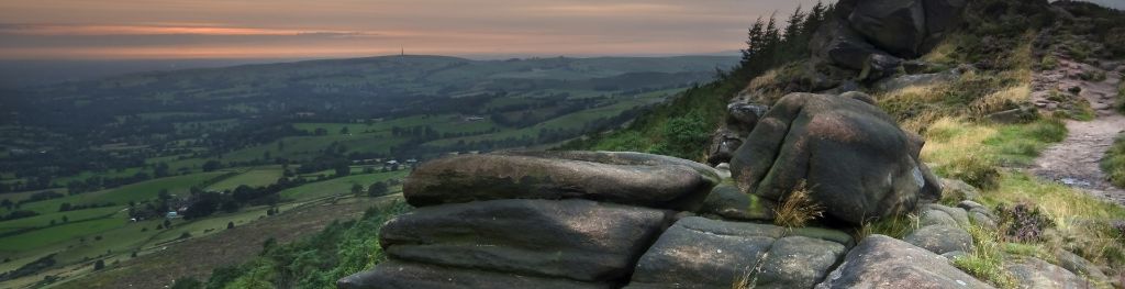
The Peak District is home to a wide variety of magnificent hills, moors, outcrops and gritstone edges.