
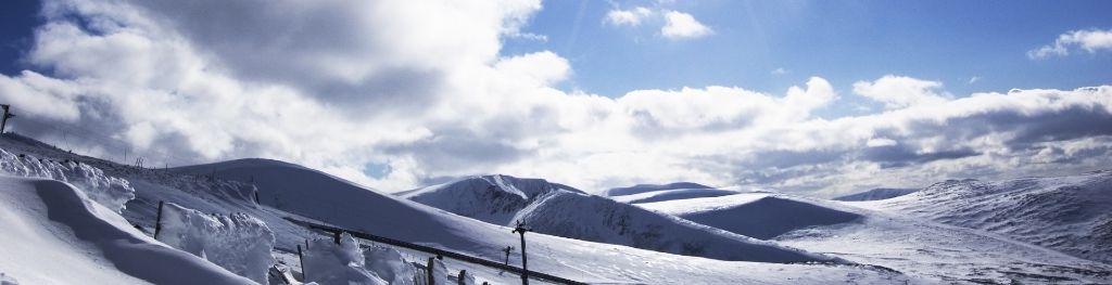
Mountain weather
South Grampian and Southeast Highlands Mountain weather forecast table
Confidence
High at first, becoming low for from Thursday.
This evening forecast
Sunny then clear intervals along with some scattered showers which could be on the heavy side. Strong westerly summit winds easing. Patchy hill fog.
Mountain weather hazards
Hazards apply at or above 300m, reflecting the more severe conditions which can occur at altitude.
 Poor Visibility
Poor visibility presents challenging route finding conditions. Visibility could be significantly less than 50 metres in all directions with few or no visual references, especially on featureless moors or plateaux. Distances become hard to judge and cliff or cornice edges can be difficult to recognise. These conditions require good navigational skills. There is a risk of white-out conditions when mist or fog is combined with extensive snow cover.
Strong Sunlight
Harmful UV levels from sunlight increase with altitude giving a greater risk of sunburn and eye damage, even on some overcast days. On breezy days, the cooling effect of wind on exposed skin may disguise any feeling of sunburn until it is too late. If there is snow cover, glare increases the effect of UV rays especially on the eyes. It is advisable to wear sun block, protective clothing such as a long-sleeved top and hat and have good quality eye protection.
Heavy Persistent Rain
Heavy and persistent rain can lead to drenched clothing and footwear with waterproofs often becoming soaked through, especially if accompanied by strong winds. This can lead to significant loss of body heat and an increased likelihood of hypothermia. Terrain may turn increasingly boggy underfoot while streams can flood and become impassable. There may also be a risk of flooding in valleys or glens. If there is snow cover, a heightened avalanche hazard is possible and avalanche reports should be consulted where available.
Mountain weather forecast
Bright start with sunny spells then clouding over with some showers in the afternoon, perhaps some longer spells of rain in the west later. Some hill fog. Fresh summit winds.
| Time | 00:00 | 03:00 | 06:00 | 09:00 | 12:00 | 15:00 | 18:00 | 21:00 |
|---|---|---|---|---|---|---|---|---|
Weather (at 800m) |
|
|
|
|
|
|
|
|
Chance of precipitation (at 800m) |
10% | <05% | <05% | 10% | 30% | 60% | 70% | 40% |
Wind direction and speed (mph)
Altitude above mean sea level
| Time | 00:00 | 03:00 | 06:00 | 09:00 | 12:00 | 15:00 | 18:00 | 21:00 |
|---|---|---|---|---|---|---|---|---|
| 1100m |
W
24
|
W
25
|
W
22
|
W
18
|
SW
19
|
SW
17
|
SW
16
|
SW
14
|
| 900m |
W
17
|
W
18
|
W
16
|
W
15
|
SW
16
|
SW
13
|
SW
11
|
SW
10
|
| 600m |
W
12
|
W
13
|
W
12
|
W
12
|
SW
12
|
SW
9
|
SW
7
|
SW
5
|
| 300m |
SW
5
|
W
5
|
W
7
|
W
9
|
SW
9
|
SW
6
|
SW
4
|
SW
3
|
| Glen |
SW
5
|
SW
5
|
W
7
|
W
9
|
W
10
|
SW
7
|
SW
4
|
S
3
|
Wind gust (mph)
Altitude above mean sea level
| Time | 00:00 | 03:00 | 06:00 | 09:00 | 12:00 | 15:00 | 18:00 | 21:00 |
|---|---|---|---|---|---|---|---|---|
| 1100m | 30 | 30 | 27 | 24 | 26 | 22 | 20 | 17 |
| 900m | 23 | 23 | 22 | 22 | 23 | 18 | 15 | 13 |
| 600m | 22 | 23 | 20 | 20 | 20 | 16 | 13 | 10 |
| 300m | 12 | 15 | 16 | 18 | 18 | 13 | 10 | 7 |
| Glen | 11 | 13 | 16 | 18 | 20 | 13 | 9 | 6 |
Altitude above mean sea level
| Time | 00:00 | 03:00 | 06:00 | 09:00 | 12:00 | 15:00 | 18:00 | 21:00 |
|---|---|---|---|---|---|---|---|---|
| 1100m |
2°
|
1°
|
1°
|
3°
|
3°
|
3°
|
3°
|
3°
|
| 900m |
3°
|
3°
|
3°
|
5°
|
6°
|
5°
|
5°
|
4°
|
| 600m |
6°
|
5°
|
6°
|
8°
|
9°
|
8°
|
7°
|
7°
|
| 300m |
7°
|
6°
|
8°
|
12°
|
12°
|
10°
|
9°
|
9°
|
| Glen |
7°
|
6°
|
9°
|
13°
|
13°
|
11°
|
10°
|
9°
|
| Freezing Level |
1,300m
|
1,300m
|
1,200m
|
1,400m
|
1,500m
|
1,600m
|
1,600m
|
1,600m
|
Altitude above mean sea level
| Time | 00:00 | 03:00 | 06:00 | 09:00 | 12:00 | 15:00 | 18:00 | 21:00 |
|---|---|---|---|---|---|---|---|---|
| 1100m |
-5°
|
-6°
|
-5°
|
-2°
|
-2°
|
-2°
|
-2°
|
-2°
|
| 900m |
-2°
|
-2°
|
-2°
|
1°
|
1°
|
1°
|
1°
|
1°
|
| 600m |
2°
|
1°
|
3°
|
6°
|
6°
|
5°
|
5°
|
5°
|
| 300m |
6°
|
4°
|
7°
|
10°
|
10°
|
9°
|
8°
|
8°
|
| Glen |
6°
|
5°
|
7°
|
11°
|
11°
|
10°
|
10°
|
9°
|
Additional weather information
Met Office Aberdeen meteorologist's view
Conditions deteriorating markedly in the afternoon
Weather
A dry sunny start, then clouding over by late morning. Scattered showers breaking out these becoming more widespread during the afternoon with some longer spells of rain possible, occasionally heavy. The rain easing from mid evening but remaining overcast and samp.
Chance of cloud-free hill tops
80%, falling 40% in the afternoon and 20% in evening
Low cloud and visibility
Patchy cloud at 900m at first. Cloud then lowering to 700-800m during the afternoon with patches 500m in south and west, and lowering further in the evening. Some moderate to poor visibility in rain at lower levels too.
Mountain weather information
Weather
Rain dying out in the early hours. The morning starting cloudy in places with hill fog but cloud already starting to break up and increasingly sunny conditions will develop during the morning though the odd sharp shower is possible at first. A fine sunny afternoon and early evening and clear after dark.
Chance of cloud-free hill tops
30% rising 90% or more during morning.
Maximum wind speed expected
Northwesterly 20 gusts 30mph at first easing 10-15mph.
Temperature
- At 800m Plus 8 rising to Plus 11 Celsius.
- Glen Plus 12 rising to Plus 17 Celsius.
- Freezing level Above the summits.
Low cloud and visibility
Banks of cloud at 600-800m at first breaking up then no low cloud and very good visibility.
Mountain weather information
Wed 11 Jun
Sunrise:
Sunset:
Dry with prolonged sunshine, then high cloud increasing in the evening. Warmer and increasingly humid.
Thu 12 Jun
Sunrise:
Sunset:
Bright or sunny intervals but the chance of some heavy thundery showers, perhaps longer spells of heavy rain. Warm and humid.
Fri 13 Jun
Sunrise:
Sunset:
Bright or sunny intervals but the chance of some heavy thundery showers, perhaps longer spells of heavy rain. Warm and humid.
Updated at:
Summit specific forecast
Mountain summit forecast map
Loading map…
Key
Including South and East Cairngorms National Park, Aberdeenshire and Angus Hills, Ben Vrackie, Ben Lawers, Loch Tay and Ochils
For snow and avalanche hazard forecasts please visit Scottish Avalanche Information Service